Showing posts with label National Park Service. Show all posts

Wednesday, August 03, 2011

The Golden Gate Bridge


The Golden Gate Bridge isn't my favorite bridge in the world.
That would be the Mackinac Bridge in Michigan, because my
Grandpa built the steel for it when he worked at the American
Bridge
works steel company in Gary, Indiana. However, the Golden
Gate is definitely the most beautiful. I must have been a civil engineer
in a past life, because I find bridges like the Golden Gate fascinating.
Next year, the Golden Gate Bridge turns 75 years old and celebrations
and improvements are being made for the occasion.


The Golden Gate is currently going through seismic retrofitting,
and as a result, there is lots of construction going on to make it
happen. I really wanted to get some good photos of the bridge,
but due to the construction, foggy weather and the fact that the
road going up into the Marin Highlands was closed for some reason,
meant it wasn't meant to be. I guess I will have to find my photos
I took on our last visit in the pre-digital camera days and make some
scans to get the pictures I want.


The National Park Service via the Golden Gate National Recreation
Area
has done a good job of posting signs, and letting people know
what is going on with the bridge. I'm very impressed with the
GGNRA. They're a collection of 38 different locations, tied together
by a single organization to promote and protect the valuable natural
and historical resources. We've visited quite a few of the locations
and I'm sure over the years, we'll see the rest.


Things started to clear a bit as we were ready to depart,
leaving a great view of the city. I think that all Americans
should see this bridge sometime in their lifetime. It's a
monument of American know how, ingenuity and hard
work. All wrapped up in a beautiful setting.

Monday, August 01, 2011

Marin


Even though it's right across the Golden Gate Bridge from a
major city, much of Marin County has a almost rural feeling to
it. If I lived in San Francisco, I would want to come here
frequently just to decompress from all the busy-ness of the city.


I really enjoy coming to Muir Beach when we're here. It reminds
me a bit of Taylor's Mistake, near Christchurch New Zealand. It's
compact, peaceful and there aren't huge crowds. Lynn enjoys
watching the waves and I think it reminds her a bit of the beaches
in New England, where she grew up. While we were walking on
the beach, we were lucky enough to see a small pod of porpoises!


The National Park Service and the Golden Gate National
the beach, returning the area to a more natural state.


Once you drive north from the beach, the drive is pretty
steep and you'll come to the Muir Beach Overlook. Walking
down a small trail will allow you to see for miles up and
down the coast.


During World War II, this entire area was lined with small
bunker-type facilities called Base-End Stations. From these
stations, soldiers would view ships and triangulate the speed,
distance and direction to coordinate with nearby Artillery Units.
All of the hardware has now been removed, but it would have
been a cold and blustery assignment to work at one of these
stations.


While we were driving north to Stinson Beach, we saw these
interesting looking sail boats headed south along the shore.
In all, there were seven of them and they reminded me a bit of
Chinese Junks or Polynesian Catamarans. I would find out
later, they were indeed Catamarans, and of New Zealand
Māori origin! They had left New Zealand in April on a
trans-Pacific voyage to tell of the plight of the world's oceans
and of Pacific peoples. It's really amazing that one part of
"our" world is connecting with another part, so far from each
other, and totally by chance!


You can read more about the voyage and the voyagers by
clicking THIS link...


Stinson Beach is a more traditional bathing beach located
just up the coast from Muir Beach. It was a weekday, so
it wasn't very crowded. However, not a lot of people were
getting into the water since it was a chilly 56 degrees
Fahrenheit. The water never gets that warm in these parts.
It takes a pretty brave soul to swim in these waters on a
regular basis.


Just up from Stinson Beach is a really pretty drive up
Mount Tamalpais, or Mount Tam for short. It's the
highest point in Marin County at 2,574 feet and most
of it is protected parkland. There are lots of pretty
views and beautiful woods on the drive to the top.


Once you get to the top, the view is pretty remarkable. It was
a fairly hazy day, but you could still see San Francisco and the
East Bay pretty clearly, as well as most of the Marin Headlands.
Well worth the drive up the twisting road.

In other visits we've seen Muir Woods National Monument where
there are huge Redwoods and Point Reyes National Seashore.
Both of which are also located in Marin County. However, we
just didn't have time to go there on this visit. Maybe next time.

Tuesday, March 29, 2011

Colorado National Monument


We can see it from our back window, but nothing beats making the
drive through Colorado National Monument. On May 21st, it will
be celebrating it's 100th Anniversary as a National Monument and
we feel very fortunate that we're within a few minutes drive to visit.
Today was no exception, as the weather was beautiful and from
Rim Rock Drive, you could see for many many miles. Independence
Monument (in the photo) actually had climbers on the top and I
was kicking myself for not having my better camera to get photos
of them. Alas, the camera on my phone had to suffice. Climbing
this large spire of sandstone is no small feat since it rises upwards
of 450 feet from the canyon floor. No, I have no plans of doing this.
I'm lucky I can climb 4.5 feet, let alone 450 feet! We continued the
rest of our drive though Glade Park and enjoyed the nice weather.
It looks like Spring might finally be on it's way.

Friday, August 13, 2010

Fort Laramie


Just west of the Wyoming/Nebraska state line is one of my favorite
parks: Fort Laramie National Historic Site. It was a primary stopping
point for pioneers heading west. The original fort was built in the
1830's, and the current version was decommisioned in 1890. The
original Treaty of Fort Laramie was signed there in 1851 and was to
ensure that the Native Americans in the area would keep their land
in perpetuity. As you can probably guess, this treaty was later violated
by the government.
The grounds of the park are really interesting and a visitor has access
to all of the buildings in various levels of refurbishment. Like most of
the countryside around the fort, the park has a very wide-open feel to
it, and even though there were probably 200 people there, it felt like we
had the place to ourselves. I enjoy historical sites like this that involve
the visitor, while not being too commercial.


Thursday, August 12, 2010

Scotts Bluff


Just five short miles from Brown Sheep is Scotts Bluff National Monument.
We've visited Scotts Bluff several times in the past few years, so we didn't
have a prolonged visit, but it's definitely a good place to pause and reflect.
Many of the pioneers headed west passed right through here and Scotts
Bluff was a landmark to them and a sign that the crossing of the prairies
was almost over and the Rockies lay ahead.


This is a rather cliched view of Scotts Bluff, but I still enjoy it, and the
weather and conditions were perfect enough for me to get a good photo.

Thursday, July 08, 2010

George Rogers Clark


While growing up in Indiana, we took "Indiana History" in
elementary school. One of my heroes was George Rogers
Clark
. Besides being the older brother of the more famous
William Clark (of Lewis and Clark fame), he led Colonial
Militiamen to capture Vincennes (Fort Sackville) and secure
the west for the Americans during the Revolutionary War.
This eventually led to the land that would later become
Indiana, Ohio, Illinois, Michigan, Wisconsin and part of
Minnesota to be ceded to the newly formed United States
(The Northwest Territory) at the end of the war. In later
years, he founded the City of Louisville, Kentucky.


What I didn't know until today, (and am ashamed as a
native Hoosier and Vexillologist) is that his expedition had
a flag. His troops carried it on their campaign to capture
Vincennes. Why I didn't know this, I have no idea!

According to Wikipedia: "... the 13-striped, red and green
banner is the only banner historically documented, and
was one of the first “American Flags” flown in the modern
State of Indiana. The pattern has been flown by Indiana
National Guard
units deployed in both Iraq and Afghanistan.
A red and green flag is still flown at the George Rogers
Clark National Historic Park
".

I know...unless you're from Indiana, a Vexillologist, or a
student of the Revolutionary War, none of this really matters
to you, but I think that more less-known historic figures like
George Rogers Clark should get more attention.

Sunday, May 16, 2010

Newspaper Rock


On our way home, just south of Moab, Utah we made the turn off
of Highway 191 toward Newspaper Rock. It's on the way to the
Needles District of Canyonlands National Park so it's actually a
fairly busy road for being in the middle of nowhere. However,
the 15 mile or so drive is definitely worth it as you are rewarded
with a spectacular panel of petroglyphs, left during a 2000 year
period. Archaic, Basketmaker, Fremont, Pueblo, Ute, Navajo and
Anglo cultures have all left their marks here. We enjoyed our brief
stay here, but we found the "wall" of toilet paper in the restrooms
to be curious!

Lowry Pueblo


Just northeast of Hovenweep is a large area of Bureau of
Land Management (BLM) land called Canyons of the Ancients.
Canyons of the Ancients is a National Monument, but instead
of being managed by the National Park Service, it's operated
by the BLM. It's kind of an odd area because it's interspersed
with juniper forests, sagebrush plains and large swaths of
irrigated farms. After driving through much of this varied
terrain, we came to Lowry Pueblo, which is part of the monument.


The pueblo is covered with a large metal roof to protect it.
It's very similar to the covering at Casa Grande in Arizona.
Constructed almost a thousand years ago, the ruins themselves
were once home to around 100 people.


My favorite spot in the ruins are the multiple rooms and inner
kiva, which are currently located under the roof. It was bright
and sunny today, but with the roofs that would have been
covering the pueblo in historic times, it might have looked
very similar to this view.


A short walk from the main pueblo is the Great Kiva. This would
have been used for ceremonial, religious and community functions.
It's said that the unique figures at the bottom of kiva represent
summer people and winter people.

Exploring Hovenweep


We had a great night of sleep and we are actually getting really
good at breaking down camp. Who knows...by the end of the summer
we might actually be able to wrap it all up in a half hour! We made
our way over to the Visitor's Center where the main trail surrounding
the ruins at Hovenweep begins. Hovenweep was a small community
of farmers and hunters located around a small canyon. From the
trail, one can see most of the dwellings and they are all pretty
spectacular. Add to the fact that hardly anyone was here besides
us, made it even better.


The ruins here are in average condition, but to me, that helps give
one a feeling of how they looked when they were first discovered.


We left the Square Tower group near the Visitor's Center and drove
toward the Holly/Hackberry Group. Even fewer people visit this
remote area and it is located a short drive down a dirt road to the
northeast. We hiked in over some really interesting slick rock
to the Holly Group and there it was with a commanding view of the
canyon.


Indian Paintbrush is one of my favorite flowers and they were here in
abundance as well as many other varieties.


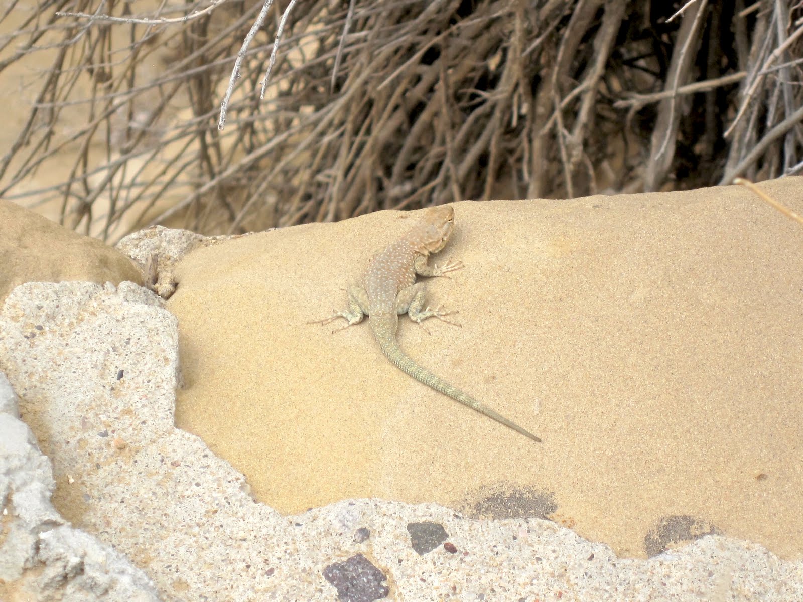
We saw all kinds of lizards along the trail, but this yellow-headed
collared lizard did a wonderful job of posing for us.

Saturday, May 15, 2010

Camping at Hovenweep


In 2009, only 37,848 people visited Hovenweep National Monument,
making it the 10th least visited Monument in the National Park
system. If that number increases by two for 2010, Lynn and I
can be thanked because we decided to stop here to camp for the
night on our way home. It's a great little park that has a lot of
different Anasazi (Ancient Puebloan) structures, stradeling the
Utah/Colorado border.


Even though we pulled into the small campground at around
5:30, we found a pretty nice little spot, overlooking a nearby
canyon, and Ute Mountain, far to the east. Unlike the past two
nights at Chaco, there was no wind, and the temperatures were
relatively warm.


Apparently, it takes very little to make us happy and we
discovered that we were going to be the first to use the
fire pit that had recently been installed at our site. It
performed like a champ!


Because the weather was so nice, there weren't any clouds, and
we were able to get a spectacular showing of stars. Probably the
best display we've seen since we last wintered on the Ice a few
years ago. The moon was just a sliver in the sky, certainly helping
our view.

Leaving Chaco


A visit to Chaco could take many days to see everything, but
we had to leave, knowing we'll come back someday soon. We
stopped by the Visitor's Center before heading out and now
the old center has been replaced with a temporary yurt. Yurts
are pretty neat buildings but because this yurt is still fairly
small compared to the old Visitor's Center, none of the old
displays, detailing the history of the area were located here.


The old Visitor's Center has been condemned and is scheduled
for demolition. Apparently, it was built on soft clay and when
the remodeling crew went in to start, it was discovered that
the building was unstable. Lynn and I pondered that in a
place where buildings a thousand years old are the attraction,
modern man can't build a structure that will last more than
50 years!


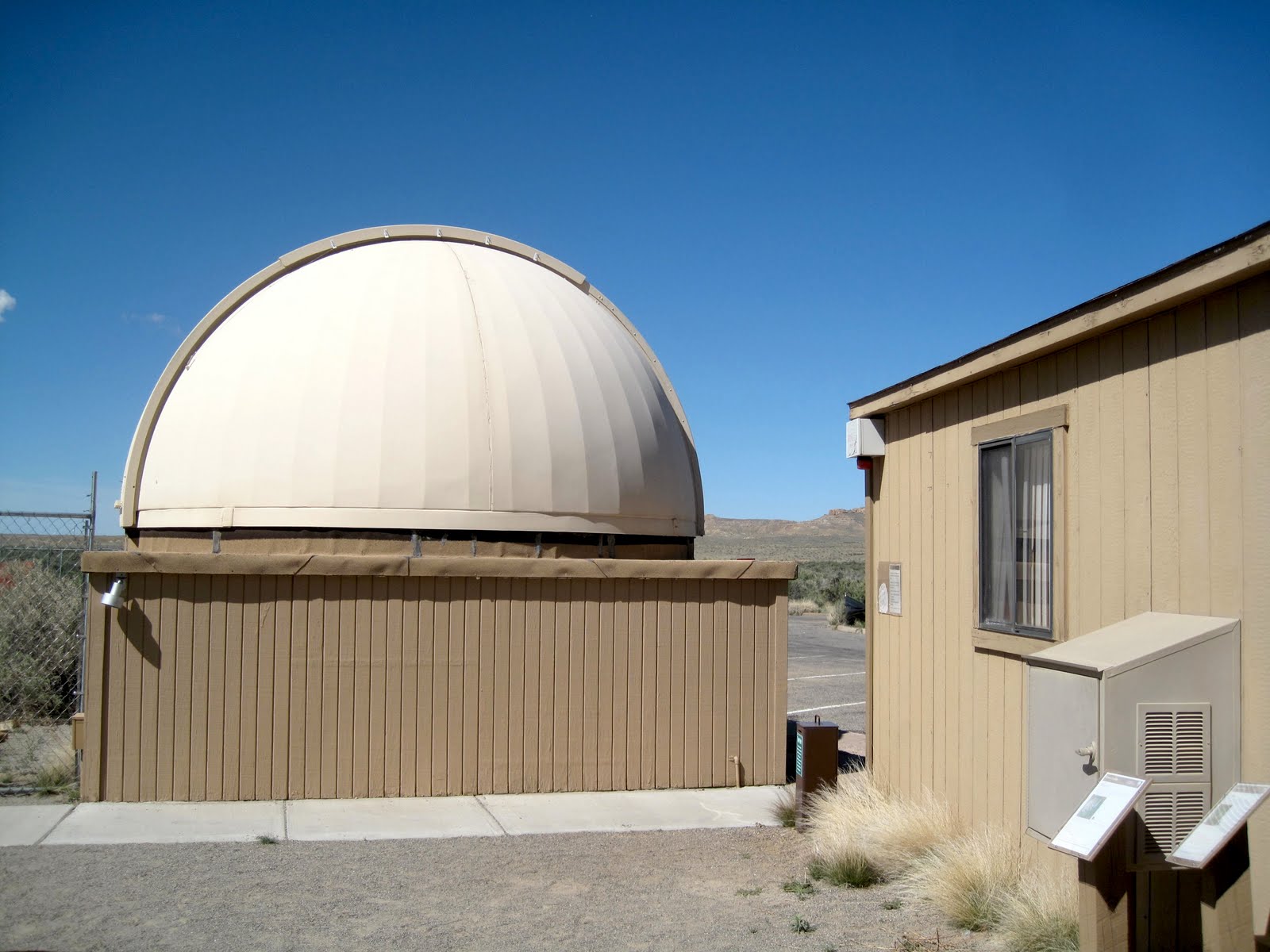
Chaco is a Dark Sky site, meaning that there is very little
light pollution present and is a fantastic place to view the
night sky. As a result, the National Park Service has taken
advantage of that and has a wonderful sky watching
program and even has a great observatory in place. To our
surprise, there was a park volunteer named Bob Bohley that
was operating a telescope at the Visitor's Center this
morning. With a special filter on his telescope, he was
able to show us the Sun and several large flares erupting
off of it's surface. I've seen photos of this before, but never
live on a telescope. It was very interesting and Mr. Bohley
did an excellent job educating everyone that viewed this
sight.


Chaco is one of 20 locations in the United States and one of
890 locations in the world that have been listed as UNESCO
World Heritage Sites. This is an important designation as it
is a protection of Mankind's existence and culture. I think
that Chaco definitely is a good representation of this.

Friday, May 14, 2010

A Day of Exploring


Exploring the Great Houses such as Pueblo Bonito and Chetro
Ketl are always interesting and we could take a week exploring
all the different ruins here, but we were most interested in
visiting ruins that we hadn't visited before. This would involve
a bit of hiking, which we definitely up for. The first site we
checked out was Kin Kletso. At one time, it contained about
55 rooms, 4 kivas and 1 tower kiva. It was actually built by
McElmo phase people who came from the north, late in the
period in which Chaco was occupied.


Much like the other sites at Chaco, almost all of the wood had
to be brought in from miles and miles away. Kin Kletso's beams
were no different. Quite a task for a people who didn't know of
the wheel.


I enjoy seeing the different masonry and doorway styles in
each of the pueblos.


Along the trail, there were a number of petroglyphs. Chaco was
also a huge center of astronomy and we found a circular design
that might have been used to measure the seasons. The sun
would shine at different points of the circle on major astronomical
events of the year such as solstices and equinoxes.


Another small site we visited was Casa Chaquita. It's currently
unexcavated and was probably built around 1100. It was also
a good place to stop for lunch!

Because this area is very dry, there isn't a lot of wildlife in the area,
but we did see a fairly large number of lizards.
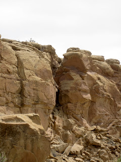

At the beginning of the day, we had bold ambitions. The boldest of
which was hiking the Pueblo Alto trail. This would mean hiking up
the cliff side (the difficult part) and then hiking across the top of the
cliff side to overlook Pueblo Bonito and visit the Pueblo Alto complex.
Wait...not so fast. When we got there, we looked at the climb...steep,
but not un-doable. It also included a VERY narrow section where one
has to squeeze through between several huge sections of rock.
We started up and found the trail to be very rough. It hardly qualified
as a trail at all. We took a quick vote and decided to save it for a time
in which the trail might be improved. Rest assured Mom...your youngest
child isn't a complete idiot!
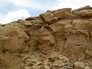

As we were headed back to the car, we saw this couple scrambling
up the cliff side and decided we had made the right decision.


With our hiking for the day completed, we had the option of checking
out other pueblos, going back to the campsite to read (me) or knit
(Lynn). Instead, we decided to exit out the south end of the park
toward the Navajo town of Crownpoint. The sign warned that the
road would be rough. Ha! it wasn't lying, As rough as the road is
entering the park from Nageezi in the north, this road was much
more wash-boardy.


However, there were lots of beautiful views available.


I'm pretty sure we were never "quite" on this angle while driving the
road, but it certainly felt like it sometimes.


Along the way, we drove by a Navajo ranch that had a number of
jewelry items for sale "Self Serve". A few little signs near each piece
asked people not to steal them. It's interesting that people would
actually think of doing so.


We came to a sign that left us scratching our heads. Were we headed
to Heaven...or Hell?


I was interested in visiting Crownpoint. For one reason, it is one
of the few areas of the Navajo Nation that we haven't visited and
I also grew up near the town of Crown Point, in Indiana. The town's
name was definitely where the comparison ended however. it's not
a bad little town. Just very remote and much much smaller. We
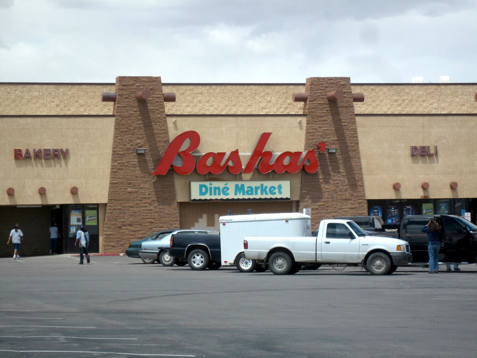
stopped at Basha's (a southwestern-based grocery chain that has
locations in lots of the larger Navajo Nation towns such as
Kayenta, Ganado, Window Rock, etc.).


The southwest is known for it's dinosaur relics, but we didn't think
we'd see one on this trip! Maybe it's even the remnants of a dragon.
Albeit a happy one!


We did a bit of stargazing before bedtime. One of the reasons we came
during this time period is that we knew there would be a new moon and
this is one of the most remote areas in the Lower 48 to view stars.
There is very little light pollution. Unfortunately, there were also more
clouds that we would have liked and way more wind than we would have
liked. It made for a short sky-watching evening. Fortunately, we had a
nice fire and it made for a cozy evening.