Showing posts with label Roads. Show all posts

Sunday, August 21, 2011

Fail Better


Lynn began her journey, headed south today. Since she has to use all
of her flight legs or her whole ticket will be voided, she left via Grand
Junction Regional Airport
on a 55 minute flight to Denver. I, on the
other hand, drove to DIA to meet her at the other end. I get to spend
more time with her and she has a car while at orientation. This plan
usually works well, especially if I leave a couple hours before her flight
and am able to meet her when she comes out of the airport.

Ah. Not so fast. The key word here is "usually".

The folks at the Colorado Department of Transportation have never been
on top of my "A" List. Over ten years ago, while driving the twisting and
turning Route 36 between Estes Park and Lyons every day on a 100 mile
a day commute, I wondered why there weren't reflectors in the middle
of the road. Every other state seems to use these. This is a major U.S.
Highway after all. However, in Colorado, even the interstates don't use
them. I wrote to the Colorado Department of Transportation (yes,
I'm one of those people...a trait I inherited from my father, who liked to
effectively bitch at people who are slackers) and asked them...why? To
my surprise, I received a response. They told me the snow plows would
remove/scrape them off in the winter. WHAT? They don't have snow
in Indiana? Illinois? Minnesota? I could go on and on listing the states
that A) Have reflectors on their highways and B) Have snow! To this day,
I find this response, and CDOT, to be LAME!

This brings me back to today. I was warned by a friend that there have
been backups on eastbound Interstate 70 between the Eisenhower Tunnel
(actually the Eisenhower–Johnson Memorial Tunnel and the eastbound
tunnel is the Johnson Tunnel...most people don't know that) and Denver.
Gotcha...Thanks Susie! So I left home at 1:30. Now, I've been known, at
least by myself, to have made this trip in 3:45. Yes, I sped, but this was a
while ago, and I figure the statute of limitations has passed on my speeding
crime. Anyway, I figure that 4:30 should be plenty of time. Again, thinking
logically gets me in trouble every time.

Smooth sailing...I even stop in Edwards for ten minutes. I cross Vail Pass.
A little rain, but no traffic. Copper, Frisco, Silverthorne....oops....a sign
over the highway...20 minute metering at the tunnel...Whaaaattt!!!!
A LOOOONNNGGGG traffic jam miles from the tunnel. I figure, ok...if
this will help traffic on the east side, then I'm all for it. A seemingly long
long wait later, I'm going through the tunnel. Smooth sailing. And then,
brake lights. Lots and lots of them. This is nothing new. I expected a
delay, but nothing like this. Remember, this is not the city. Any city.
There are probably no more than 100 people within a mile of the highway
anywhere near Interstate 70 in this part of the state. I'm now averaging
5-10 miles per hour! And that's when I'm moving.

Eventually, I make it to Denver and the airport. 6:30 later! Almost twice as
long as it should have taken!

I can understand why CDOT meters people going into the tunnel. They don't
want people to get trapped in the tunnel if there is an accident, fire, etc. and
making sure it's clear is their way to ensure this. Bravo for them...However...
Get off the stick and figure something out about the eastbound situation.
The biggest problem (ok, the BIGGEST problem is that people in general are
not as bright as we'd like to think they are...including drivers on the highways),
is that there are only two lanes on most of the route. Honestly, there are a few
places (the Georgetown area comes to mind) where the mountains are just too
close to the road and they can't make it three lanes. Most miles of the highway
however, have enough room for three lanes each way. Do it. Spend some of
the money from the gas taxes and DO IT. I don't know where the money is
going and haven't been able to figure that out for years. Obviously not on
the repair of our roads. When traveling, Colorado's roads are always the worst.
Oh, by the way, during the entire stretch, there wasn't any construction or
any accidents. Can't use that excuse for the backup, CDOT.

So Colorado Department of Transportation...in the words of Samuel Becket...
"FAIL BETTER"

Saturday, August 06, 2011

The Great Basin


What exactly is the Great Basin? It's not a sink. But in a way, it kind of is.
Although a number of rivers flow into the Great Basin, none flow out to
the ocean
. Hence, the name Basin.


It's also a very very large desert. In fact, it's the largest desert in the
United States
, covering approximately 190,000 square miles. To give
you a comparison, England is only just over 50,000 square miles.
It's big.


It's also a land of wide wide wide open spaces. If you're looking to
get away from it all, this is the place. My history teacher in high school
told us that the Native Americans in the Great Basin basically ate dirt.
I scoffed at the time, but now I almost believe it. Although we drove
through the Great Basin during the day, I can imagine what it looks
like at night, with a moonless sky. Imagine the sky that your
grandparents or great-grandparents saw. No light pollution. The
clearest sky you will ever see. That's what the night sky in the Great
Basin looks like.


Finally, this pretty much sums up the Great Basin. There are no services
available for a long long distance. We are lucky that we can cover this
distance in about an hour. The early pioneers would have taken almost
a week to cover 80+ miles. There is just nothing out there.

If I had to choose one word for the Great Basin? EMPTY

Friday, August 05, 2011

Ely Nevada


Not just any town can have Wayne Newton AND Pat Nixon represented
on its Walk of Fame...


The Loneliest Road in America


Back in 1986, Life magazine deemed the section of US-50 that runs
through Nevada as the Loneliest Road in America. It wasn't necessarily
meant as a good thing, but Nevadans being good Americans took the
billing and turned it into a positive. They marketed the highway as a
scenic thoroughfare to hopefully attract more visitors to this very empty
part of the country. There are some pretty empty stretches of US-50
through this neck of the woods, but because it's summer, there are
more tourists on the road and it didn't seem to be as forlorn as it
could be. I'm guessing in the winter, this road is very lonely indeed


Much of the route parallels the historic Pony Express Trail, although
now it's just pretty standard asphalt. Because most mountain ranges
in Nevada
follow a north-south line, much of US-50 is spent driving
through a long stretch of flat, open desert, followed by a climb and a
descent of mountain ranges. If this wasn't the case and the mountains
went the opposite direction, I could visualize setting the cruise control
at 100 mph and having it seem like you were doing 50 mph.


I have to say that the road is very well maintained. Not a pothole
to be found and everything is very well marked. Colorado could take
a lesson from the Nevada Highway Department.


I agree that this is a scenic highway. It's not a road I need or would
want to drive frequently. There are enough desert vistas near our house.
However, I think that everyone (especially folks from the urban east coast
should make this drive at least once in their life. They would get a true
appreciation of what it's like to live in the West. The West isn't just
the beaches of California or the ski resorts of Aspen. It's the wide open
spaces such as this that make the West such a beautiful place. Wait...
maybe they shouldn't come. We'll keep the wide-open West our own
little secret!

Wednesday, June 01, 2011

On The Road Again


We like to be on the road, and today we definitely got our fill.
An 11 hour drive between my Mom's in Northwest Indiana, to
our stop for the night in North Little Rock, Arkansas. We made this
trip a few years ago, and it's a nice diversion from our usual trip
home via Nebraska or Kansas. Remember how we were freezing
at the Cubs game a few days ago? Well, today we more than made
up for it with temperatures in the 90's and the humidity about the
same. Driving along the Mississippi River in Missouri and Arkansas,
we could smell the river and the aftermath of the flooding that
happened a few weeks ago in that area. We also heard a huge
buzzing coming from the trees along the road. It turns out that
they were cicadas. They only breed every 13 years and apparently,
this is the year. Overall, it was a long, but leisurely drive. Tomorrow,
we head toward Dallas.

Sunday, March 06, 2011

Not Your Average Road Signs


While driving today, we saw some road signs that you just don't
see back home. We're used to seeing signs to watch out for
deer, elk, etc. This sign warns us to watch for Tasmanian Devils.


This sign, of course, cautions us to be on the lookout for Kangaroos!


My favorite is this sign...watch out for Wombats!

We saw a Penguin caution sign too, but weren't quick enough to
snap a photo. Oh well, maybe next time!

Sunday, August 15, 2010

Hebron Colorado


I grew up in Hebron, Indiana and it's population is around 4000 people.
Pretty small. However...we drove through Hebron, Colorado and it's a
bit smaller.


How small? Population 0. Yes, Zero. The big nil. Zip. Nada. In other
words...tumbleweed city. This is the only house in Hebron Colorado, and it
appears to have been abandoned years ago. I know that my home town
has it's problems once in a while, but at least it has 4000 people that
call it home!

Saturday, August 14, 2010

The Oregon Trail


Between 1841 and 1869, an estimated 400,000 pioneers followed the
Oregon Trail from Missouri to Oregon. A small park near Guernsey,
Wyoming contains a spot where so many wagons travelled, they cut
a four foot deep trench into solid rock. These are considered the best
preserved ruts anywhere along the trail. Here, it's quite easy to put
yourself into the shoes of those early pioneers crossing the west since
you can actually "see" and "feel" where they tread.


Friday, August 13, 2010

Fort Laramie


Just west of the Wyoming/Nebraska state line is one of my favorite
parks: Fort Laramie National Historic Site. It was a primary stopping
point for pioneers heading west. The original fort was built in the
1830's, and the current version was decommisioned in 1890. The
original Treaty of Fort Laramie was signed there in 1851 and was to
ensure that the Native Americans in the area would keep their land
in perpetuity. As you can probably guess, this treaty was later violated
by the government.
The grounds of the park are really interesting and a visitor has access
to all of the buildings in various levels of refurbishment. Like most of
the countryside around the fort, the park has a very wide-open feel to
it, and even though there were probably 200 people there, it felt like we
had the place to ourselves. I enjoy historical sites like this that involve
the visitor, while not being too commercial.


Thursday, August 12, 2010

Scotts Bluff


Just five short miles from Brown Sheep is Scotts Bluff National Monument.
We've visited Scotts Bluff several times in the past few years, so we didn't
have a prolonged visit, but it's definitely a good place to pause and reflect.
Many of the pioneers headed west passed right through here and Scotts
Bluff was a landmark to them and a sign that the crossing of the prairies
was almost over and the Rockies lay ahead.


This is a rather cliched view of Scotts Bluff, but I still enjoy it, and the
weather and conditions were perfect enough for me to get a good photo.

Tuesday, August 10, 2010

Beetle Kill


Since I left for the Ice last October, we hadn't been more than fifty
miles east of home. This morning we took off on a mini-roadtrip
to one of Lynn's favorite places. Brown Sheep Wool in Mitchell,
Nebraska
. Not a long trip, but one that took us to quite different
scenery than we are used to here at home. A large bulk of the
trip took us through the mountains on Interstate 70. We were
shocked by how much beetle kill there has been on the pine
forests that cover much of the mountains.
According to an article in the Denver Post, 500 thousand acres
are being infested by the Pine Beetle each year. Although the
beetles are a natural part of the ecosystem process, the warm
winters and recent droughts have made the problem even worse.
Unfortunately, there's not way to stop the beetles and that areas
full of dead trees are susceptible to fires for the next 20 years.
However, nature has a tendency to recover and eventually new
seedlings will sprout and regenerate the forests. In the meantime,
it's not a pretty sight.

Friday, July 16, 2010

Twizel Colorado


Last night Lynn was leafing through the Yellow Pages (don't ask me
why) when she announced, "We should go to Battlement Mesa!" Ok,
now I'm also not sure why she wanted to go to Battlement Mesa. We've
driven past it dozens of time on Interstate 70, either heading east or
west and even stopped for a night a couple of times in nearby Parachute,
(this is when we lived in Estes Park and thought it would be cheaper
to spend the night there instead of Glenwood Springs) which is just
south of Battlement Mesa. So we got in the car, and made the short
45 minute drive to the northeast. For lack of a better description,
Battlement Mesa is kind of an odd place. It was developed in the early
80's as a housing community for workers in the oil shale industry.
When Black Sunday happened and the energy companies pulled out
of the Western Slope, Battlement Mesa had to re-fashion itself as a
retirement community. Now that the energy companies are coming
back to the area, many many more natural gas drilling employees
are moving back in. Regardless, it's a planned community and it
definitely looks like it. The streets are too perfect, the roads are just
the right width and length. It has no downtown to speak of either.
It has kind of a strange Stepford Wives feel to it. In fact, it reminds
us a lot of another planned community in New Zealand, named Twizel,
that also gave us the creeps. Twizel was built for workers building
a nearby hydroelectric project. I'm sure the people of Battlement
Mesa are very nice, but the town itself doesn't give us a warm, fuzzy
feeling. We did our obligatory drive through of the "town" (hard to
call it that because there aren't many retail and shopping options...
just subdivisions, a golf course, rec center and a couple of gas
stations) After all of this, I'm pretty sure Lynn won't be having
a strange urge to visit Battlement Mesa anytime soon.

Friday, July 02, 2010

Melanie's Visiting


Our friend and co-worker, Melanie is visiting us for a couple
of nights on her way from Glacier National Park, eventually to
her parent's house in Kansas. One of the best things about
where we live is that we're on a major east-west interstate
highway (Interstate 70) and lots of Ice-folk are headed either
east or west across the country and stop by to see us. We had
a great dinner tonight at the Ale House and shared a lot of
stories and laughs. Tomorrow, she's off to Denver to see more
Ice friends. We'll see her again in a couple of months on the Ice.

Sunday, June 20, 2010

Piñon Mesa


It seems that if you live in an area for a while, you've seen
pretty much everything and there aren't any new discoveries
to be made. No so. We took a drive toward Glade Park, and
kept going south, eventually ending up on Piñon Mesa. Since
it's about four thousand feet higher than Grand Junction, it
was also about 20 degrees cooler, making it a very comfort-
able 72 degrees.


A lot of this area is dedicated to ranching and we saw herds
of cows everywhere.


Enoch Lake was a pleasant little spot, tucked away on a side
road.


With meadows come wildflowers and we came at a perfect time
of the year to see really large fields of Arrowleaf Balsamroot.


Ranching has been a way of life up here for many years, and
there are lots of old abandoned barns and homesteads that
testify to this.


I love seeing the huge aspens.


Way above Glade Park.

Tuesday, June 01, 2010

Driving to Las Vegas


Last year, when we visited Las Vegas, we were borrowing Lynn's
sister's truck and drove in from Arizona. We then flew home from
Vegas to Grand Junction. So this time we were going to be driving
from Grand Junction to Vegas and back. I was looking forward to
seeing scenery I hadn't visited before. Our favorite part of the
trip was driving through the San Rafael Swell. A huge rock out-
cropping that runs for miles and miles through the center of
Utah. If you look closely at the above photo, you can see how
large it is by comparing it to the dark car on the highway.
When we pulled off the road at a rest stop, I learned that Marie
Curie had visited the area around the turn of the last century
because there is so much uranium in the area. Our seven
hour drive through the desert brought us to Las Vegas at
about 6:30, but we forgot about the time change, Vegas being
on Pacific time, so we ended up making great time!

Thursday, May 27, 2010

Sunday Drive on a Thursday


In my grandparent's day and even in my parent's day, people
would take Sunday Drives. However, I take into account three
things in this day and age:

1. Life is too short to wait for Sunday
2. Our car gets good mileage and GJ gas is "fairly" reasonable
3. Trips don't have to be long...in fact, they can be in the vicinity

A small trip we take occasionally is on B /4 Road to 26 3/8 Road,
which turns into 26 7/8 Road. Yes, the naming of roads in the
Grand Valley is semi-mundane, but it does make it fairly easy to
get around. Anyway, along this road is the myriad of cemeteries
(Catholic, Oddfellow, Masons, etc.). Lynn likes to take drives through
cemeteries and look at the dates and imagine what kind of lives
the people resting here had. Just down the hill is the Department
of Energy offices. All gated and "secretive". At this point, you turn
onto 26 3/8 Road. Paved at this point, there are large bluffs on
your left and the Gunnison River on the right. There is a Potter's
Field on the left. This is a cemetery for indigent people who
apparently couldn't afford a "proper" burial. The last person
was buried here in 1936, so I wonder where indigent people are
buried now? Just a few yards away is the City Police Department
Firing Range. Maybe that's why people aren't buried in Potter's
Field anymore since they wouldn't get any rest. As 26 3/8 Road
veers and becomes 26 7/8 road again, we've seen a small
waterfall flowing from the top of the bluff on the left. Not so
today though as it's hot and dry. Before the last stretch of road
leading to the Redlands Dam, you cross the Union Pacific train
tracks. We've seen these before farther down the Gunnison in
Dominguez Canyon, but I can't help but wonder each time I
cross these tracks, where they end up headed south. At the
end is the BLM boat ramp into the river. There are sometimes
cars sitting along the road, some with people in them and
sometimes not. Today we saw someone sleeping in their car.
Adds mystery to the area I suppose. This isn't the best Sunday
drive in the world, but it's away from the traffic and one pretty
much has the whole road to one's self.

Sunday, May 16, 2010

Newspaper Rock


On our way home, just south of Moab, Utah we made the turn off
of Highway 191 toward Newspaper Rock. It's on the way to the
Needles District of Canyonlands National Park so it's actually a
fairly busy road for being in the middle of nowhere. However,
the 15 mile or so drive is definitely worth it as you are rewarded
with a spectacular panel of petroglyphs, left during a 2000 year
period. Archaic, Basketmaker, Fremont, Pueblo, Ute, Navajo and
Anglo cultures have all left their marks here. We enjoyed our brief
stay here, but we found the "wall" of toilet paper in the restrooms
to be curious!

Lowry Pueblo


Just northeast of Hovenweep is a large area of Bureau of
Land Management (BLM) land called Canyons of the Ancients.
Canyons of the Ancients is a National Monument, but instead
of being managed by the National Park Service, it's operated
by the BLM. It's kind of an odd area because it's interspersed
with juniper forests, sagebrush plains and large swaths of
irrigated farms. After driving through much of this varied
terrain, we came to Lowry Pueblo, which is part of the monument.


The pueblo is covered with a large metal roof to protect it.
It's very similar to the covering at Casa Grande in Arizona.
Constructed almost a thousand years ago, the ruins themselves
were once home to around 100 people.


My favorite spot in the ruins are the multiple rooms and inner
kiva, which are currently located under the roof. It was bright
and sunny today, but with the roofs that would have been
covering the pueblo in historic times, it might have looked
very similar to this view.


A short walk from the main pueblo is the Great Kiva. This would
have been used for ceremonial, religious and community functions.
It's said that the unique figures at the bottom of kiva represent
summer people and winter people.

Friday, May 14, 2010

A Day of Exploring


Exploring the Great Houses such as Pueblo Bonito and Chetro
Ketl are always interesting and we could take a week exploring
all the different ruins here, but we were most interested in
visiting ruins that we hadn't visited before. This would involve
a bit of hiking, which we definitely up for. The first site we
checked out was Kin Kletso. At one time, it contained about
55 rooms, 4 kivas and 1 tower kiva. It was actually built by
McElmo phase people who came from the north, late in the
period in which Chaco was occupied.


Much like the other sites at Chaco, almost all of the wood had
to be brought in from miles and miles away. Kin Kletso's beams
were no different. Quite a task for a people who didn't know of
the wheel.


I enjoy seeing the different masonry and doorway styles in
each of the pueblos.


Along the trail, there were a number of petroglyphs. Chaco was
also a huge center of astronomy and we found a circular design
that might have been used to measure the seasons. The sun
would shine at different points of the circle on major astronomical
events of the year such as solstices and equinoxes.


Another small site we visited was Casa Chaquita. It's currently
unexcavated and was probably built around 1100. It was also
a good place to stop for lunch!


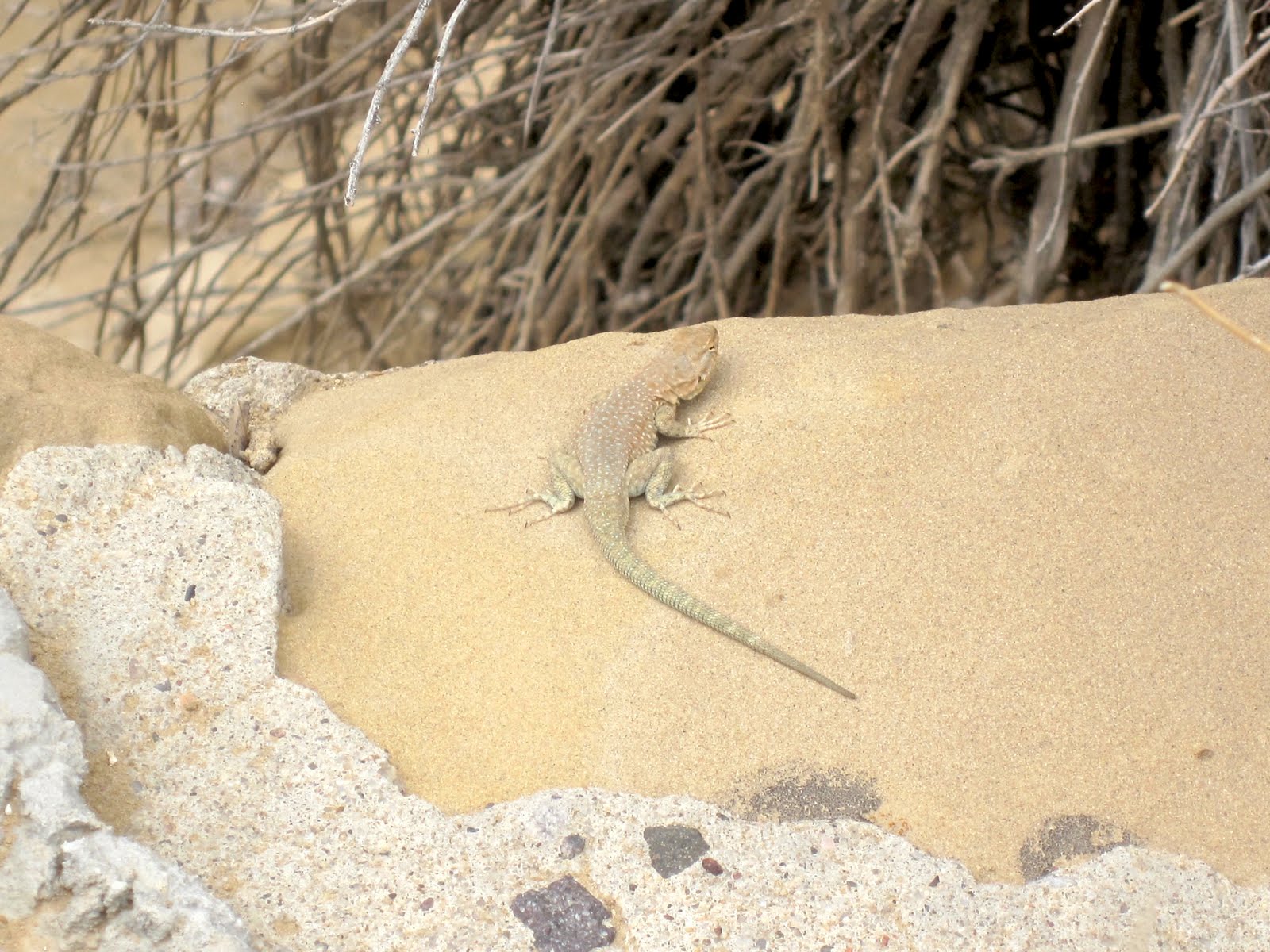
Because this area is very dry, there isn't a lot of wildlife in the area,
but we did see a fairly large number of lizards.


At the beginning of the day, we had bold ambitions. The boldest of
which was hiking the Pueblo Alto trail. This would mean hiking up
the cliff side (the difficult part) and then hiking across the top of the
cliff side to overlook Pueblo Bonito and visit the Pueblo Alto complex.
Wait...not so fast. When we got there, we looked at the climb...steep,
but not un-doable. It also included a VERY narrow section where one
has to squeeze through between several huge sections of rock.
We started up and found the trail to be very rough. It hardly qualified
as a trail at all. We took a quick vote and decided to save it for a time
in which the trail might be improved. Rest assured Mom...your youngest
child isn't a complete idiot!


As we were headed back to the car, we saw this couple scrambling
up the cliff side and decided we had made the right decision.


With our hiking for the day completed, we had the option of checking
out other pueblos, going back to the campsite to read (me) or knit
(Lynn). Instead, we decided to exit out the south end of the park
toward the Navajo town of Crownpoint. The sign warned that the
road would be rough. Ha! it wasn't lying, As rough as the road is
entering the park from Nageezi in the north, this road was much
more wash-boardy.


However, there were lots of beautiful views available.


I'm pretty sure we were never "quite" on this angle while driving the
road, but it certainly felt like it sometimes.


Along the way, we drove by a Navajo ranch that had a number of
jewelry items for sale "Self Serve". A few little signs near each piece
asked people not to steal them. It's interesting that people would
actually think of doing so.


We came to a sign that left us scratching our heads. Were we headed
to Heaven...or Hell?


I was interested in visiting Crownpoint. For one reason, it is one
of the few areas of the Navajo Nation that we haven't visited and
I also grew up near the town of Crown Point, in Indiana. The town's
name was definitely where the comparison ended however. it's not
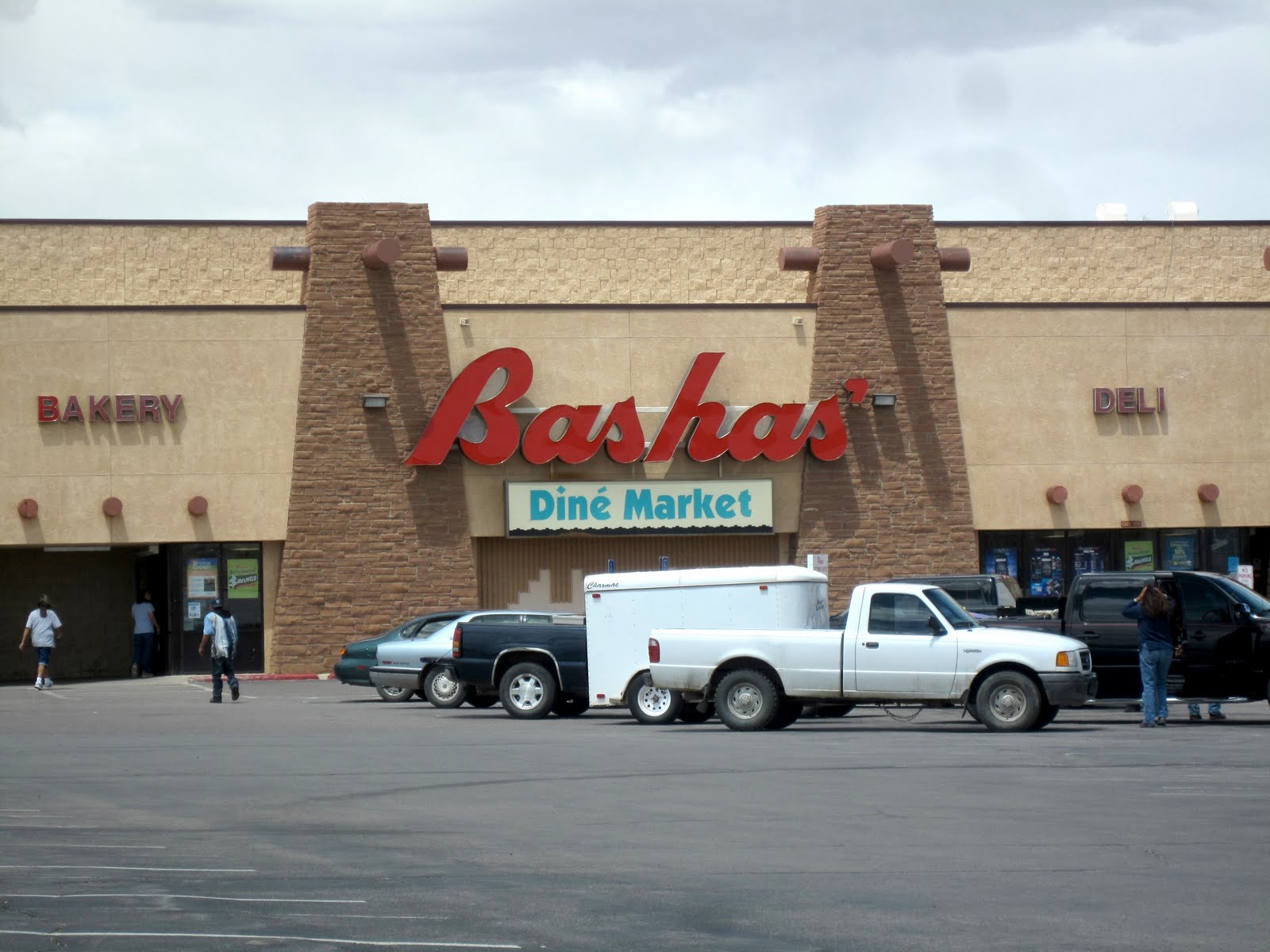
a bad little town. Just very remote and much much smaller. We
stopped at Basha's (a southwestern-based grocery chain that has
locations in lots of the larger Navajo Nation towns such as
Kayenta, Ganado, Window Rock, etc.).


The southwest is known for it's dinosaur relics, but we didn't think
we'd see one on this trip! Maybe it's even the remnants of a dragon.
Albeit a happy one!


We did a bit of stargazing before bedtime. One of the reasons we came
during this time period is that we knew there would be a new moon and
this is one of the most remote areas in the Lower 48 to view stars.
There is very little light pollution. Unfortunately, there were also more
clouds that we would have liked and way more wind than we would have
liked. It made for a short sky-watching evening. Fortunately, we had a
nice fire and it made for a cozy evening.